Posts

Showing posts from September, 2019

Human geo. Blog #8!

Image
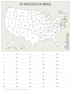
Good day Reader, my name is Lane Miller. Today in human geography we got a new topic of mapping the world. We are doing the United States, all 50 of em, and well here are a list of them. 1. Washington 2. Oregon 3. California 4.arizona 5. Nevada 6. Utah 7. Idaho 8.montana 9.wyoming 10.colorado 11. new Mexico 12.texas 13.oklahoma 14.kansas 15.nebraska 16.south Dakota 17. north Dakota 18. Minnesota 19. Iowa 20. missurio 21.arkansas 22.louisiana 23.wisconsion 24.mishagain 25.illinois 26.indiana 27.ohio 28.kentuky 29.tennese 30.missisipi 31.alabama 32.georgia 33.florida 34.south Carolina 35.north Carolina 36.virgina 37.west Virginia 38. Pennsylvania 39.new york 40. Vermont 41.new Hampshire 42.maine 43.massachesets 44. Rhode island 45. Connecticut 46.new jersey 47.delewhere 48.maryland 49.hawie 50.alaska
Greetings Reader, my name is Lane Miller. This is my 7th blog post and today in human geography we talked about time zones. Time zones are a way of showing how in some places it is a different light level than in other places. For instance, if it is 8:30 here than it would be 5:30 in Los Angeles. we also had to define a few things: UTC- universal central time, GMT- Greenwich mean time witch restes on the equator, Daylight Savings Time-  is the practice of turning the clock ahead as warmer weather approaches and vise Versa, and finally  Standard Deviation-  a quantity calculated to indicate the extent of deviation for a group as a whole. You might ask how do geographer tell where to put each time zone, well. Normally there is a time zone every 15 degrees around the earth. However, there are some deviations to this rule, like in Nepal its a 30-minute difference instead of an hour. and there are also some countries out there that choose not to follow the GMT. like in North Korea they have

geography post #6!

Shalom reader, my name is Lane miller. and this is my 6th geography post. today in geography we talked about the geographic grid. the geographic grid is the grid that shows us where things are on the earth. This is also called latitude and longitude. some of the most important lines are, the prime meridian, witch goes thro grenitch England, the equator, witch is the closes point to the sun, the tropics, and the artics, and finally the international dateline. these are some of the most important lines. the way they made the longitude was they took grenitch England and put a line thro it then fill in the gaps. then with latitude they did them from the equator.

Human Geo. post #5

Howdy Reader, my name is Lane Miller and this is my blog. today in human geography we got a new key topic so another blog post.  How do Geographers Describe where things are? Well, they use maps! Maps are the main tool in the geographer's arsenal. However because our earth is a sphere, despite what some people say, it is hard to accurately display it on a 2D surface or a map. because of a thing called distortion. Distortion is kind of like the geographers Kryptonite because when a 3D sphere is placed onto a map the farther you get away from the center, or equator, the bigger the landmasses seem to get. For instance, the Mercator projection, the most widely used projection, shows Greenland to be the size of Africa. This is because Africa is on the equator and Greenland is very close to the pole. In reality, Greenland is 14x smaller than Africa, this is one of the biggest predicaments in the geography world, trying to find the best projection.  we also had to define a few key terms:

Geography blog #4!

Image
Greetings Reader, my name is Lane Miller. Today I am writing my 4th blog in geography class.  todays geography class was the most fun I have had at John Carroll so far! we went over the countries of north and south America. We highlighted a few of them and did some fun geography games. Now I am a self-proclaimed geography veteran, so this was very easy and exciting for me. One of our challenges was, we had to label all the countries on these two maps.  They are of north and central America, and South America respectively.  So without further ado the countries of north and south America....in order......from my head. North American map canada USA Mexico guatamala belize el salvador honduras Nicaragua costa rica Panama cuba jamaca Haiti Dominican republic South American Map Columbia Venezuela Guyana suriname French Guiana, which is not an independent country but a "French Protectorate State" equador peru Bolivia brazil paraguay chile argent

Geography class blog #3

Salutations Reader, my name in Lane Miller, and today in human geography we got a new key topic. It was Mental Mapping, it sounds like a math term. Well, what is metal mapping you might ask? It is using your brain to make a map in your head. this can be useful for finding a way from point B to point A and for organizing and sorting info for future reference. One challenge we had to do in class was to draw a map of the world from our mind. Now for me, it was pretty easy but I did run into some difficulty.  I had lots of trouble with the scaling of my map. like I cut off half of Asia. This was because I made north and south America to big.  Because of this, my map did not look proportional.
Hello reader, my name is Lane Miller and this is my second blog post. today in human geography we got a new key topic,  How Do Geographers Describe Where Things Are Located? Well, geographers use two different terms to describe where places are the absolute and relative location.  An absolute location would be its longitude and latitude, or where it is exactly on the planet's surface. For instance, the Washington monument is at  38.889467, -77.035247, this is its absolute location. Relative location is describing a place by its surroundings. like if I relatively described where Maryland is I would say south of Pennsylvania, west of the Atlantic, east of West Virginia, and north of Virginia. we also had to define cartography and maps. cartography is the science of maps. and maps are tools geographers use to describe where places are.  Also, we had to explain the two ways geographers use maps. They are to identify objects absolute and relative location. And as a communication tool  t

Human Geo. Day1!

Hello Reader, my name is Lane Miller and I am a freshman at The John Carroll School this year, and am also a self-proclaimed geography/history veteran. This is why I am taking Human Geography this semester and so far it is great. Every day after class we have to write a blog post on the happenings of that day. So that brings me to here. Today we tackled or first key question "what is human geography?", well human geo. is the study of people and their communities, cultures, economies, and interactions with the environment by studying their relations with and across space and place, and how they affect the earth's environment as well as how the earth's environment affects them. Such as mountain ranges or rivers can hinder a civilization's movement/expansion, and how humans think of borders for there prospective places. We also had to define physical geography. Which is the study of earth's natural features, processes, and phenomena. Today in class we also learne